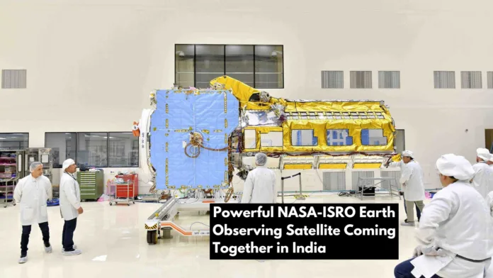
The Earth is a dynamic planet, undergoing constant changes that shape our environment and have an impact on our lives. Scientists rely on Earth observation satellites, which provide invaluable data from space, to better understand these changes and their implications. The NASA-ISRO Synthetic Aperture Radar, a collaboration between the National Aeronautics and Space Administration (NASA) and the Indian Space Research Organisation (ISRO), is one such ground-breaking mission.
Table of Contents
NASA-ISRO Synthetic Aperture Radar is a dual-frequency radar that provides unprecedented Earth insights.
NASA-ISRO Synthetic Aperture Radar is a one-of-a-kind Earth observation satellite that will carry a dual-frequency radar system that will operate in both the L-band and the S-band. This dual-frequency capability will give scientists unprecedented insights into Earth’s processes, allowing them to gain a more complete understanding of our planet’s dynamics.

Significant Achievements: Bengaluru Integration and Testing
NISAR was developed in collaboration between NASA and ISRO, with significant contributions from both organizations. A team of 160 scientists and engineers from NASA’s Jet Propulsion Laboratory (JPL) has been working in Bengaluru, India, for the past nine months, collaborating with their ISRO counterparts to integrate and test the satellite components.
Also Read: Unveiling Secrets of Ganymede: NASA Juno Mission Discovers Mineral Salts and Organics
Monitoring the Earth’s Ecosystems and Processes is one of the mission objectives.
The mission of NISAR is to provide a comprehensive understanding of the changing ecosystems and processes on Earth. The radar data from the satellite will be used to monitor a wide range of phenomena, including:
- Forest degradation and deforestation
- Land use changes in agriculture
- Wetland and coastal area dynamics
- Melting ice sheets and rising sea levels
- Land subsidence and groundwater depletion
- Natural disasters such as earthquakes, tsunamis, and volcanic eruptions are examples of natural hazards.

Understanding Ice Sheet Melt and Sea Level Rise in the Face of Climate Change
Climate change will be one of the critical applications of NISAR data. Scientists can better understand the impact of climate change on global sea level rise by monitoring the melt rate of ice sheets and glaciers. This data is critical for coastal communities and policymakers developing adaptation plans.
Disaster Management: Monitoring Natural Hazards and Mitigating Their Effects
The radar data from NISAR will also be useful in disaster management. Natural hazards such as earthquakes, tsunamis, and volcanic eruptions can be detected and tracked by the satellite, providing early warning information that can save lives and minimize damage.

Collaboration and Data Sharing: A Global Initiative
NISAR data will be freely available to scientists and researchers all over the world, fostering international collaboration and advancing Earth observation science. Because of this open data policy, scientists will be able to combine NISAR data with other datasets, leading to new discoveries and a better understanding of our planet.
Looking Ahead: NISAR and the Future of Earth Observation
The launch of NISAR in early 2024 will be a watershed moment in Earth observation. The satellite’s novel dual-frequency radar system and wide range of applications will transform our ability to monitor and comprehend Earth’s dynamic processes. NISAR data will be critical in addressing critical issues such as climate change, natural disasters, and resource management, ensuring our planet’s long-term viability.
Disclaimer:
AI was used to conduct research and help write parts of the article. We primarily use the Gemini model developed by Google AI. While AI-assisted in creating this content, it was reviewed and edited by a human editor to ensure accuracy, clarity, and adherence to Google's webmaster guidelines.


